
TREE CAMPUS HAS ROOTS IN THE PAST
by Bruce B. Harper
Trees have always been important on the Virginia Tech campus, going back to the early days of the college founding. In his semi-centennial history of the college, Ellison Adger Smyth Jr. makes a number of mentions of trees, including some very specific ones as landmarks.
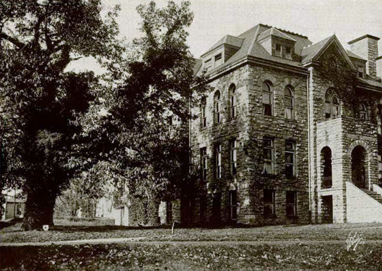
During the summer of 1893, “the land to the right of the road leading to the horticultural and experiment station building (now the extension building) was leveled, and a boulevard was constructed from the old chestnut tree (still standing by the Y. M. C. A. building) to the horticultural building. Along this boulevard “faculty row” was later gradually built.” The Y.M.C.A. building is now the Liberal Arts Building, the horticulture building stood on today’s Drill Field in front of Burruss Hall, and “faculty row” boulevard remains as the sidewalk from the Liberal Arts Building through the Burruss tunnel and on to Davidson Hall. The old chestnut tree, unfortunately, is long gone from its location between the Liberal Arts Building and McBryde.
The chestnut tree and the Y.M.C.A. from the 1917 Bugle.
The chestnut tree was still in place in 1898, as a reference point for the location of two ice houses that were replaced by an underground ice house, later replaced by a refrigerating plant.
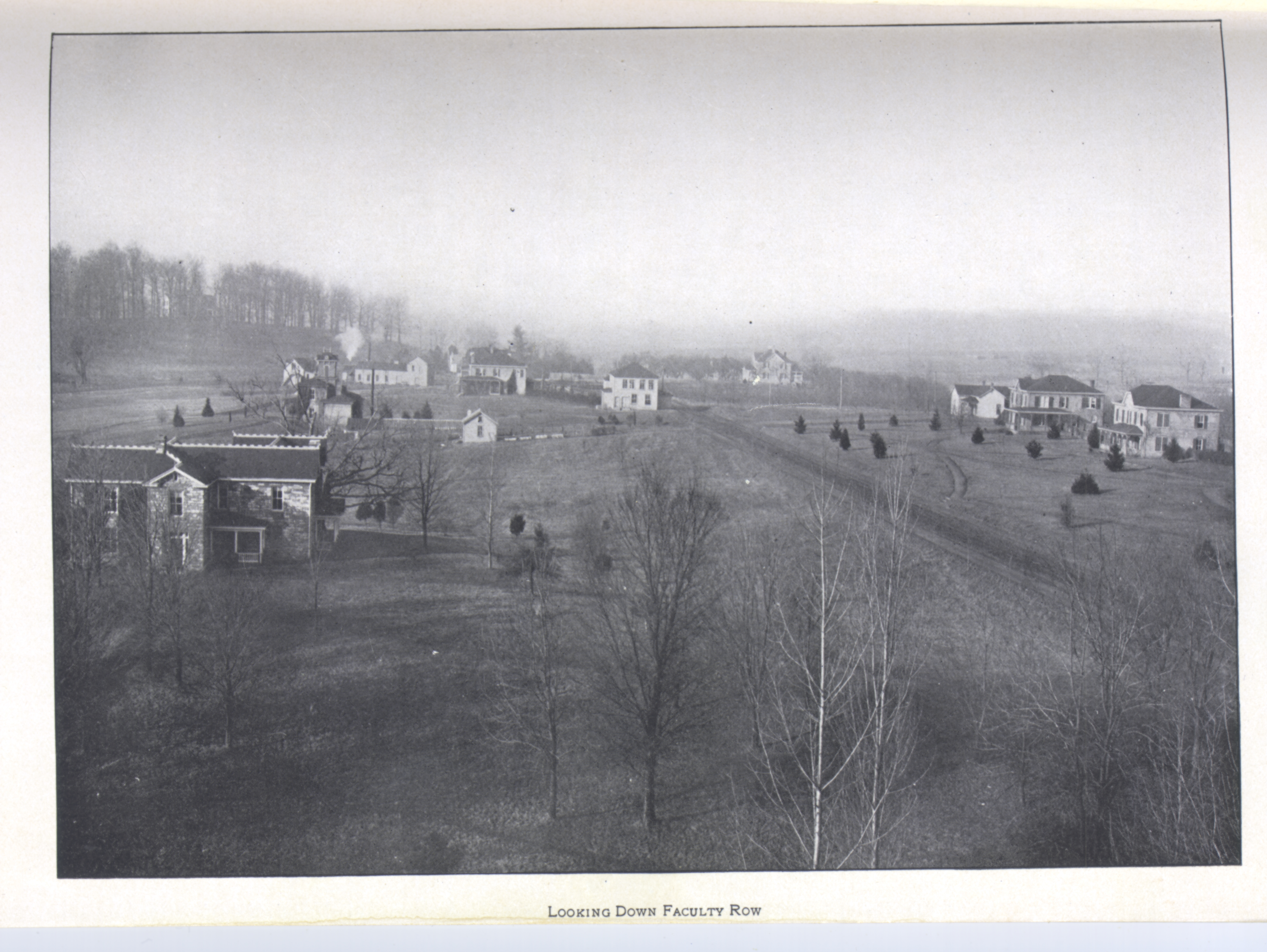
Campus expansion at the turn of the last century saw the removal of trees to make way for additional faculty housing. Smythe wrote, “The offices of the president, commandant, and treasurer were moved in September from Academic Building No. 1 to the rock house, occupied at one time as a residence by Professor Morton, and later by Professor Alwood. The latter moved to the house built for him in the old orchard, now the residence of Dr. Watson.” The “old orchard” was in the vicinity of Davidson Hall.
Smythe recounted the changes that came in the administration of John McBryde, including planting trees. “When Dr. McBryde took charge in June, 1891, the new administration found on hand to begin with: two brick academic buildings; one brick dormitory; the old Preston-Olin building, converted into a poorly-equipped shop building; two old wooden buildings (one, a small one, used as a shop, the other semi-ruinous); and five professors’ houses--eleven buildings in all. There were practically no shops or laboratories; no water works, sewerage, public hall, infirmary, laundry, or adequate lighting system. The small campus of about ten acres in front of the buildings was used as a hay meadow and there were scarcely any walks or driveways.
Looking west in this 1905 view of campus, with the administration building in the left foreground and The Grove, the tree-covered rise above it.
“Not a dollar of income was allowed by the State, not even for insurance or repairs, the scanty income being wholly derived from the Federal grant. During Dr. McBryde’s sixteen years of administration special appropriations were secured from the State amounting to $332,750, in addition to the annual sums allowed for insurance, repairs and maintenance.
“To show for this sum, eight separate purchases of land, between sixty and seventy acres in all, were made, 27 industrial plants and other similar improvements were established, 6 old buildings were renovated, 67 new buildings (25 brick, 4 stone, 5 iron, 33 wooden) were erected, 26 laboratories, 25 lecture-rooms, 18 offices, 9 halls, etc., fitted up and equipped--186 improvements in all--the campus was extended to about 75 acres, 2,000 ornamental trees were set out, and several miles of cinder walks, avenues and drives were made. Many small buildings and improvements are not herein included. In addition, a handsome stone Y. M. C. A. building was erected and furnished, largely through the efforts of the faculty and students.”
Also, during that time period, McBryde moved in 1902 from the president’s house adjacent to College Avenue (now Henderson Hall) to the new house that had been built on the west edge of campus. The Colonial Revival house was built on a tree-covered knoll known as The Grove. In 1988, the President’s House was renamed The Grove for the trees surrounding the home.
This 1930 view looking east shows the grove of trees between the Upper Quad and the student center. The war memorial was proposed to be located at the top of the drill field.
As the campus grew, orchards were relocated to the north and west of campus, in the area between Derring Hall and Prices Fork Road and across to what is now the golf course. The college also expanded by purchasing adjacent property, typically farms that included wood lots.
A 1947 map of the campus identifies a number of stands of trees: Crumpacker Woods, North Crumpacker Woods, Turkey Pen Woods, Price’s Fork Woods, Locust Thicket, Boundry Wood, Center Wood, and Heath Woods. Remnants of some of these stands of trees still exist around campus. The trees of Turkey Pen Woods can still be found between Duck Pond Dr. and the vet school. Across Southgate Drive from the Duck Pond Dr. roundabout is North Crumpacker Woods, while the relocated connection to the Corporate Research Center skirts Crumpacker Woods. Center Woods is still largely intact, located behind the research center on Plantation Road.
Price’s Fork Woods extended along Price’s Fork Road from approximately the Visitor Center to Heather Drive. Portions of that woods remain on the edge of the golf course and around the Oak Lane community. The U.S. 460 bypass cut through the woods, but a large portion of it was preserved when the Oak Manor townhouse development was built in the 1970s. The widening of Prices Fork Road to four lanes in the late 1970s did take out a number of large oak trees. Locust Thicket was in the vicinity of today’s sheep barns and fields on Plantation Road, behind the Carillion Clinic; depending on interpretation of the map, the woods behind the clinic could be the thicket.
This page from the 1948 Bugle shows the proposed layout of the new campus entrance. Commerce Hall is on the right, two proposed buildings are on the left, and Squires student center is at the center left.
Boundary Wood is still largely intact, on the west side of the bypass and north of Warm Hearth. Heath Woods, still in existence, gave name to the housing and apartment development Hethwood. Aptly named Tall Oaks Drive and other streets in the Stroubles Mill section of Hethwood wind through the woods. Today’s Stadium Woods is noted on the map, just as “Wood.”
Long gone, now covered by the New Classroom Building, parking lots, and the Perry Street parking garage is a former apple orchard and a smaller peach orchard. These, like the grove of trees between Academic Buildings 1 and 2 and Squires and Henderson halls, were removed as enrollment grew and the campus expanded. The removal of that grove caused a bit of consternation on the campus.
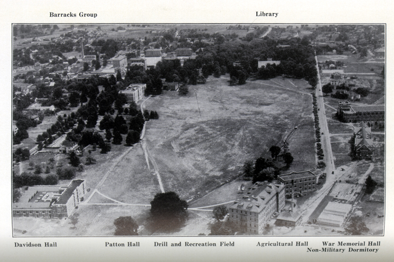
Throughout the years, several master plans were drawn up for the growing college. After World War I the Manning Plan established much of the current layout of the campus, with the oval Drill Field as the central focus. Agriculture buildings grew on the southwest corner, the War Memorial Gymnasium and dormitories were built on the south side, and Burruss and academic buildings went up on the north side.
When Dr. John Hutcheson became president of the university in 1945, he began to plan for a campus that would eventually accommodate 6,000 students. A building committee prepared a report and the Board of Visitors engaged Alfred Hopkins and Associates to develop a plan based on that report, to handle projected growth of the college by 1955. An alumni committee had also been formed to consider a memorial to those who had served in World War II. In October, 1946, the plans were revealed for the construction of a memorial at the northeast end of the drill field.
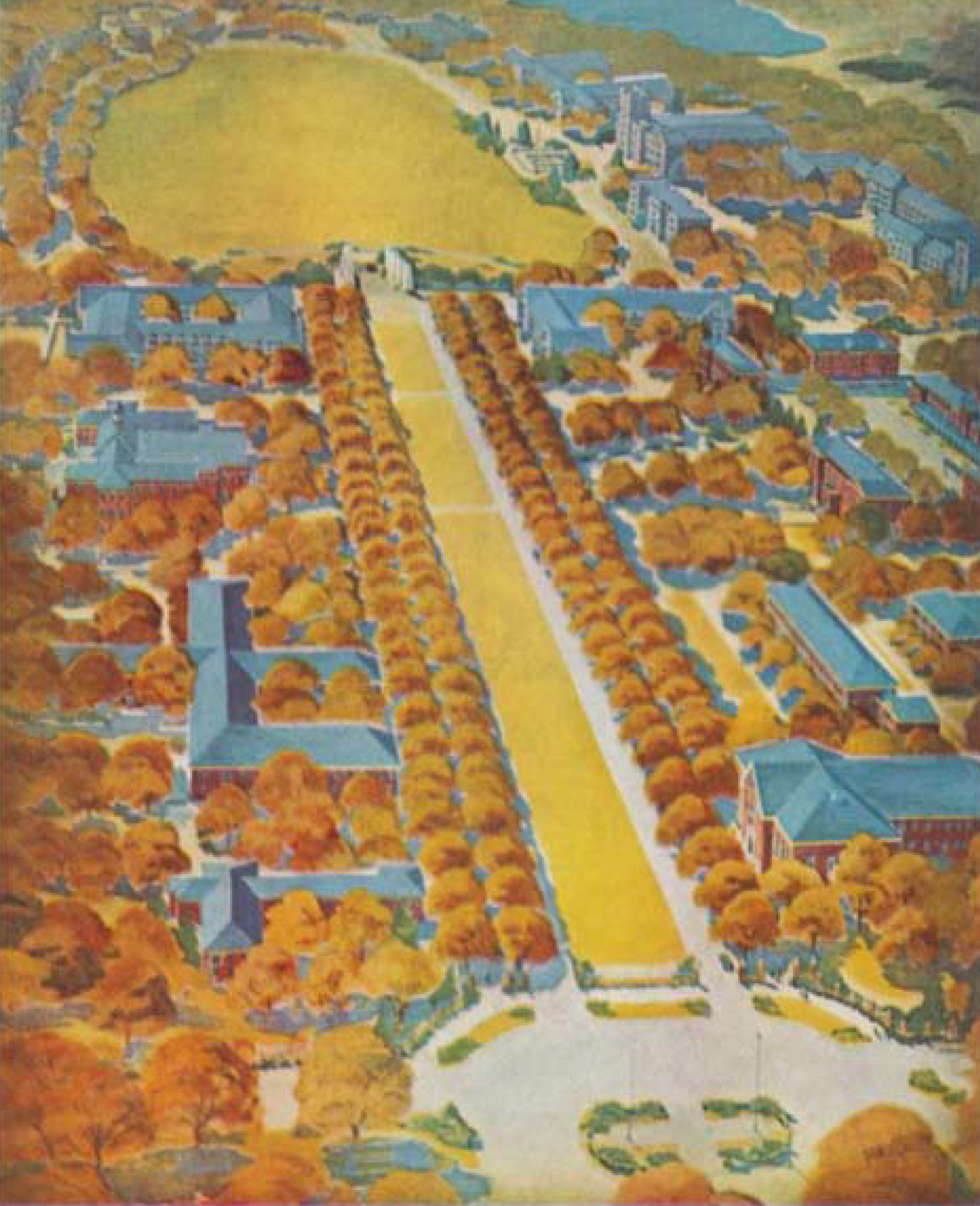
The Hopkins plan called for a new entrance to campus from Main Street. The Mall was proposed as a wide tree-lined path, with two streets separated by a wide grassy median. It was to start at Main Street adjacent to Commerce Hall, replacing the existing lane (which itself was a replacement for the original lane that ran from the Alumni Gate at the corner of College and Main to First and Second Academic buildings). It would extend past the infirmary and the student activities building, ending next to the library at the drill field in front of the new war memorial.
The plan did not sit well with alumni, who were not happy that the plan called for the grove of trees that covered much of this area was to be bulldozed for the new road. Duncan Lyle Kinnear, in The First 100 Years relates the problems of this plan.
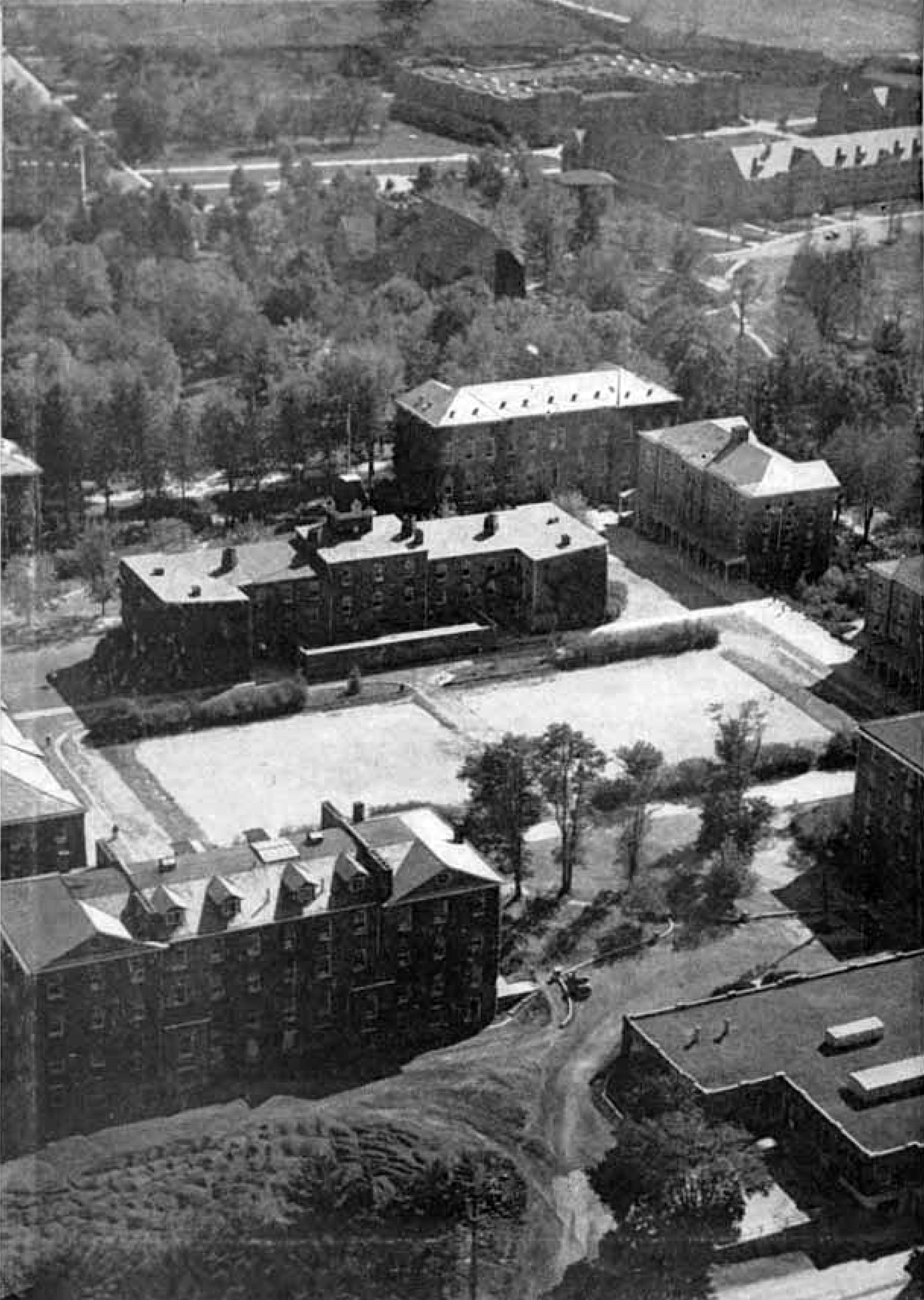
This photo from the 1949 Bugle shows the Upper Quad in the foreground with the grove of trees at the top.
Opposition to the mall developed almost at once on the grounds that destroying the trees destroyed one of the greatest natural beauty spots to be found on the campus. In spite of Hutcheson’s repeated assurances that the plan called for replanting the area with more shrubs and trees than it destroyed, opposition to the mall continued to develop. This opposition spread to the plan for the proposed memorial, which was also drawing its share of opposition, mainly from advocates of a utilitarian rather than a spiritual-type memorial.
The building committee and Alfred Hopkins and Associates continued to work on the plan, with preliminary ideas published in the 1948 Bugle. The plan was finalized and presented to the Board of Visitors in the spring of 1950. The plan ultimately called for expansion of the physical plant to accommodate an enrollment of 10,000 students and was adopted by the board. Since the announcement of the war memorial in 1946, fundraising had been in progress until funds were available to start construction in 1951.The Virginia Department of Highways started construction of the new mall before the end of the year.
Kinnear continued to describe the problems with the mall and memorial construction.
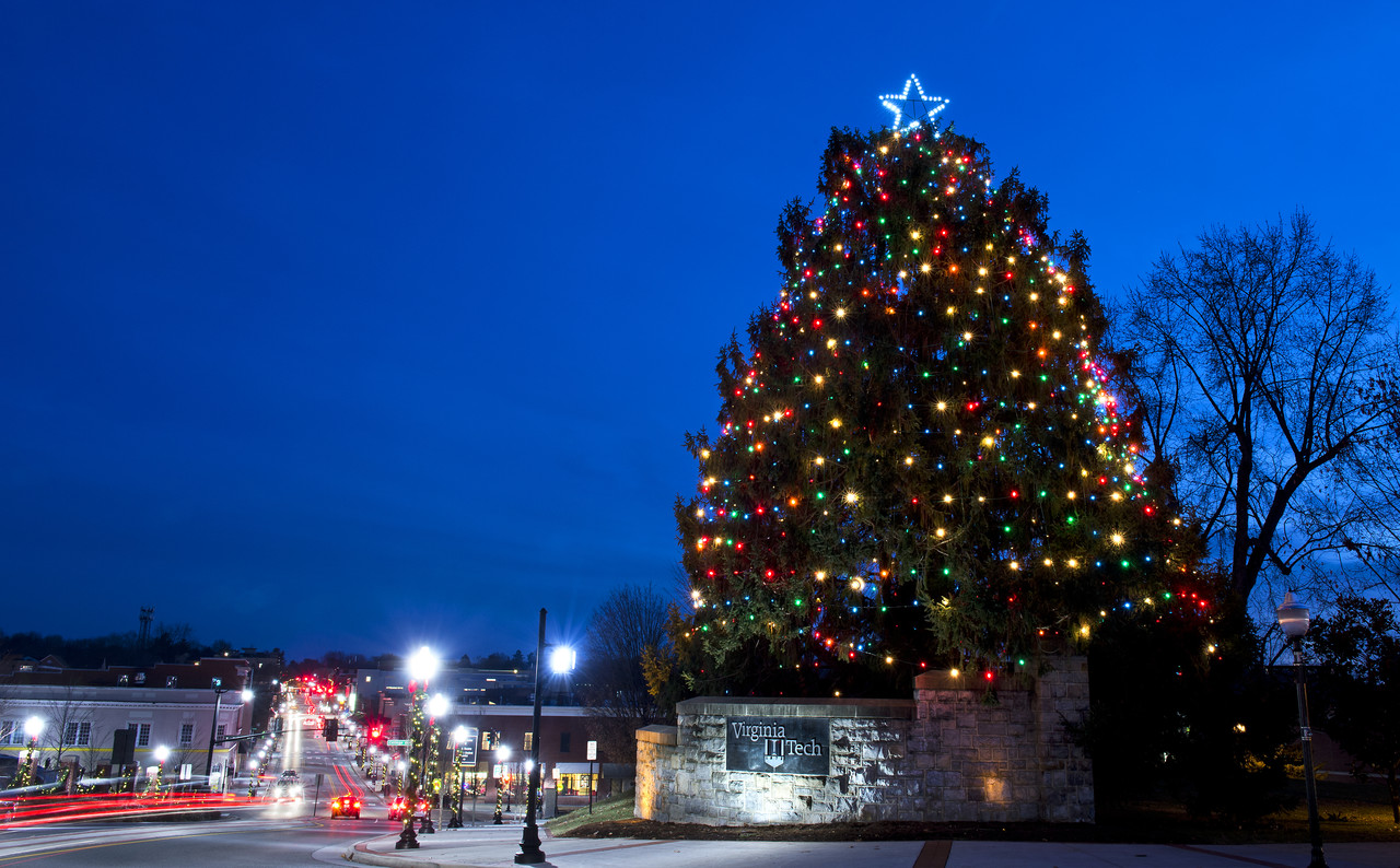
The town/university Christmas tree at the Main Street end of the Mall remains from the original grove of trees. It is located not far from the site of one of the original Preston and Olin buildings.
The mall project involved the destruction of a beautiful grove of trees. Note has already been made of the opposition which developed at once when it was learned that these trees would be sacrificed. The opposition increased and in some instances turned to bitterness as the grove disappeared leaving only raw red earth. The bitterness expressed itself in a number of ways, one of which was to denounce the administration, the school, and even the governor of the state. During much of its construction, the mall was indeed a desolate, uninspiring sight. At times even the strongest supporters of the project grew faint. One afternoon a faculty member who had supported the proposed mall from the first was joined by Chancellor John R. Hutcheson as the two were surveying the apparent desolation. Turning to Hutcheson the faculty member asked, “Dr. Jack, do you think we will ever get this spot restored to the beauty and dignity it had before construction was started on this mall?” Dr. Jack’s answer is worth recalling as one looks at the mall today. “Yes, we will.” he said. “It may not look that way now, but remember we will plant far more trees and shrubbery in connection with the mall than we are destroying. Not only will we achieve more beauty and dignity, but the mall will be practical as well and will achieve more beauty with each passing year for the next fifty years or more.” Continuing, he added, “People are blaming me for putting the forces into operation which led to this mall. I am perfectly willing to accept the blame for the mall now if the people will give me the credit for it when they view it twenty-five years from now.”
The War Memorial was finally completed and “with an impressive service of dedication was turned over to the College on May 2-9, 1960.” The scars of construction of the Mall healed and it has become the main entrance to campus. It has gone through changes through the years, with trees planted, trees removed, the median serving as construction staging areas for various projects, and crossing of it by the Torgersen Hall bridge. The most recent project was the construction of Hokie stone walls flanking the Main Street entrance.

1947 map of the campus identifies a number of stands of trees.